The Elusive Pinnacle & The Foggy Ashland of Granite Falls
Hike No. 3 was full of surprises and initial less than ideal detours. The beautiful Granite Falls is home to dozens of hikes, off of Mountain Loop Highway. The hike we chose for Saturday June 3rd was of the same name as our previous week's exploration.
I don't care to admit it, but I will risk my pride. Pinnacle Peak was supposed to be Pinnacle Lake. It was a typo on our list and a slight failure of pre-planning that took us to Enumclaw for Hike No. 2. It was a mistake that I thankfully do not regret.
So, Pinnacle Lake.
What to Expect:
The entrance is labeled Pinnacle Lake Trail and I forewarn that if you plan on visiting soon, the road up to the trail is chalk full of potholes. Many a car would do fine with the bad road conditions, but Kerby's car is not really designed for off-roading.
I really should have taken a picture while we made our way to and from the site. At one point we came to a warning sign of road damage (this was after a mile of potholes half the size of the Toyota Spark). This damage was significant and we were uncertain whether the car would make its way through without getting stuck. We managed OK by treading slowly, but there was no way to avoid the ear splitting screeches of gravel hitting the underside of the car. Both on the way up and down we stopped to check the damage. Igor survived.
You follow the winding potholed road for about 4 miles to reach the trail entrance (which took us about 30 minutes because we were driving at a necessary 10 mph). You will know you're close when you pass a left turn option to go toward Ashland Lake Trail. From there it's about another 15 minutes (assuming you too are driving 10 mph).
Pinnacle Lake Trail
We were so excited for this trail, to see the lake, to see the right Pinnacle. But sadly we did not make it. Maybe a mile into the 4 mile round trip hike we lost sight of the trail. All around and ahead of us were trees and bushes that were on a steep hill, beyond which was a long stretch of snow that seemed to make its way up, possibly to a crest. It was a drastic change from the defined path and difficult to tell where it continued on. After talking it out we decided to head back to see if there was another direction we missed or return to the car to reevaluate our hiking options.
We found no other path. We all wondered whether we should have kept going through the questionable terrain, but we weren't prepared for some of its more untrustworthy features.
Ashland Lake Trail
The Ashland trail is much more marked and guided than Pinnacle. That gave us some comfort after traversing and being stopped by wild land. There are numerous narrow but comfortable boardwalks through the trail, which felt like we were on an awesome subdued obstacle course.
At about mile 5.3 of the 5.4 mile hike, you come to a direction post which shows you an option to go to either lower Ashland lake or upper Ashland lake. We decided to do Upper Ashland because it was a slightly shorter distance.
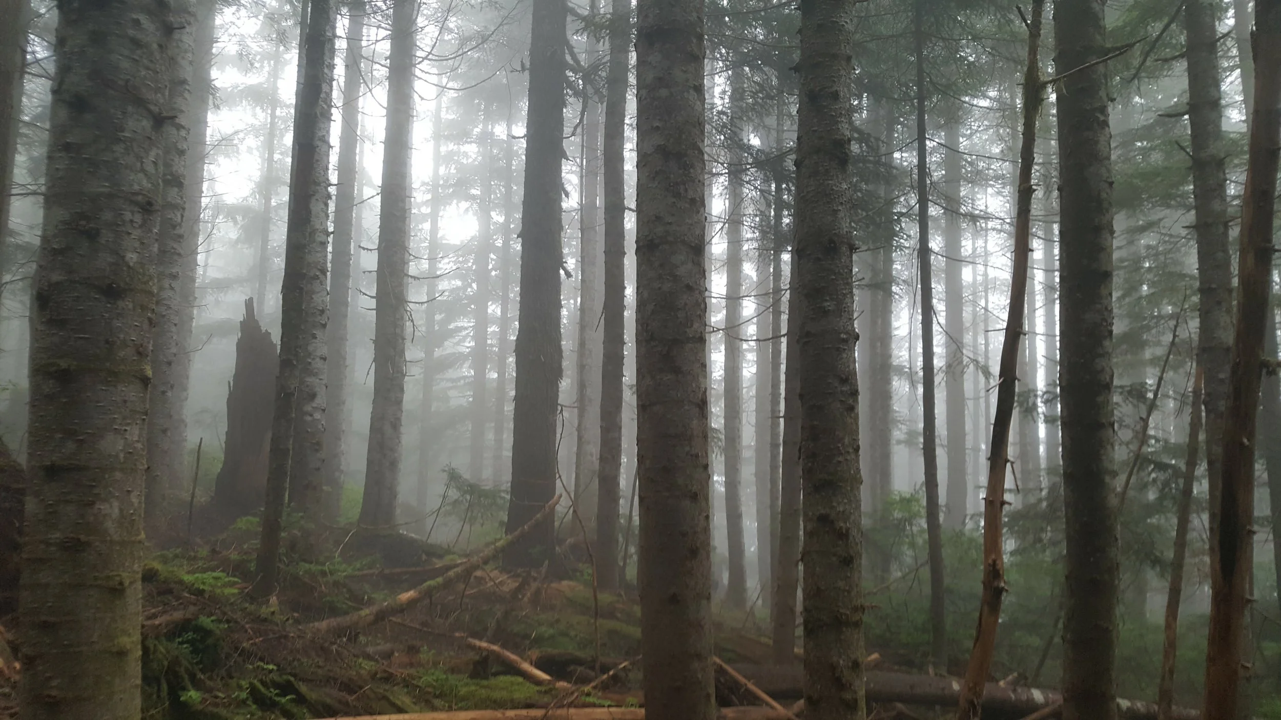
It was mystical and perfectly silent with the exception of birds chirping their unique song through the forest. The fog was thick and it was near impossible to see the trees except for a faint outline. Though clear sun-shiny skies make for ideal hikes, I loved the gray mist that shrouded everything. It added to the primeval feeling of the whole forest. Boughs, moss, and stoic ancient tree trunks surrounding you, it feels as though you've stepped back in time.
A little ways on we decided to picnic on a little logged section on the edge of the water. As we ate our noon time lunch, we watched the fog slowly lift to reveal the dark forestry behind and the smooth unrippled water below. And then just a distracted observation later, it would come back, dense and formidable.
Beaver plant Lake
I am not sure I can confidently recommend Beaver Plant Lake.
It might have been because at that point we'd been hiking for about 4 hours plus the stress of our successes and disappointments had mounted pretty high. Whether or not that played a role, the REALLY good body workout was not quite justified by the tiny body of water we discovered.
Back at the post to guide you to lower and upper Ashland, there is also a marker for Beaver Plant Lake, which is about 0.1 mile. It was a beautiful and challenging trail in that most of the terrain is full of thick rocks and precarious logs all along a steep incline. They demanded a lot of high steps and agile balancing.
But reaching the lake, its small size and inaccessibility made it slightly unfulfilling. Remnants of snow lined some of the edges, and it was beautifully pristine in its high seclusion. In all truth I'll likely give it a good length of time before I burn my medius gluteus again to see it.
Granite Falls is full of stunning landscape. From our experience, hiking early on a Saturday morning, Pinnacle trail was very quiet. Ashland had more visitors, but was never crowded. I would recommend both (Beaver Plant Lake too, ALL of the nature is beautiful, I should not gripe). And though we didn't make it to Pinnacle, the hike through the forest was a highlight in and of itself.
Where will Hike No. 4 take us?
Warm wishes,
Kels


